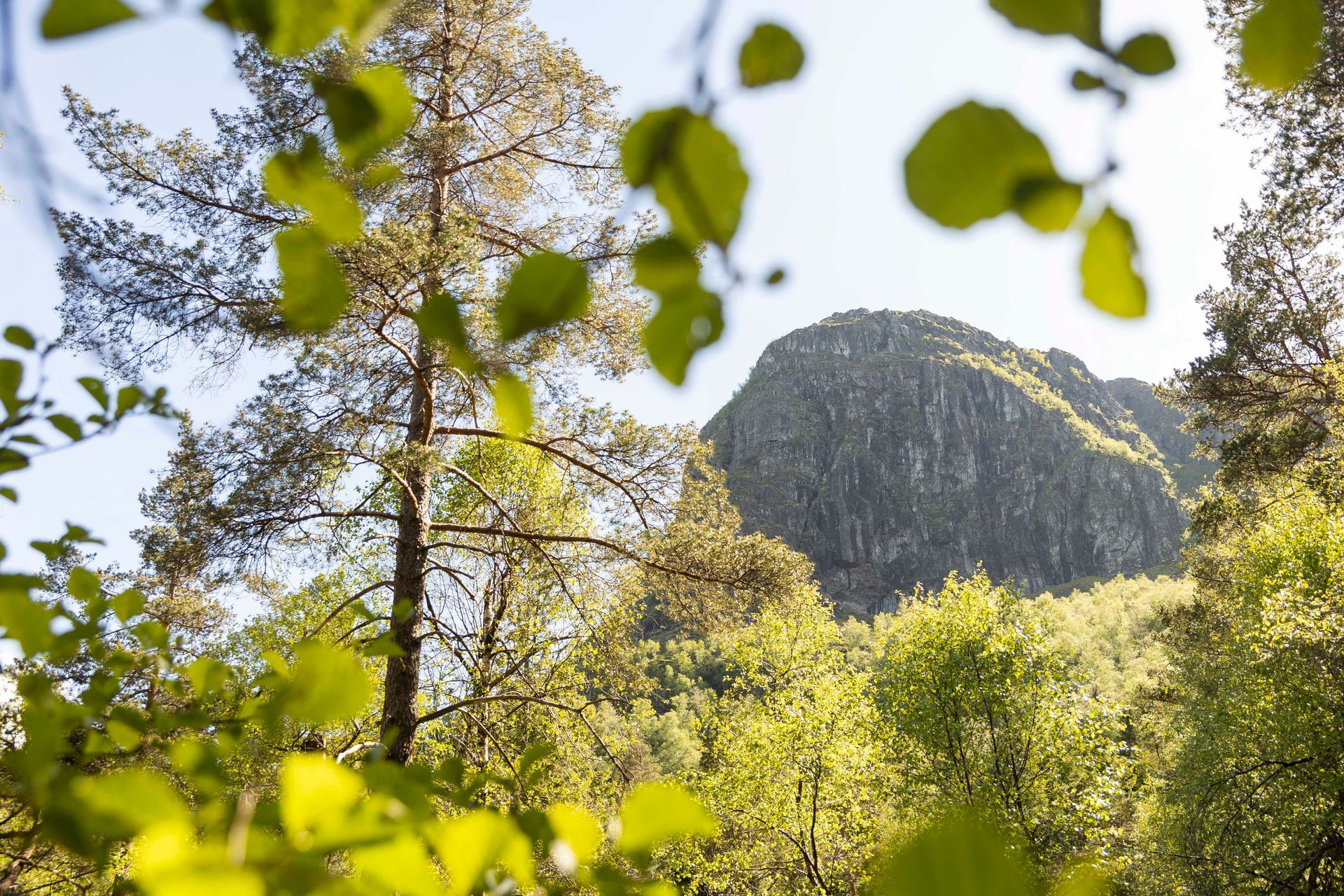
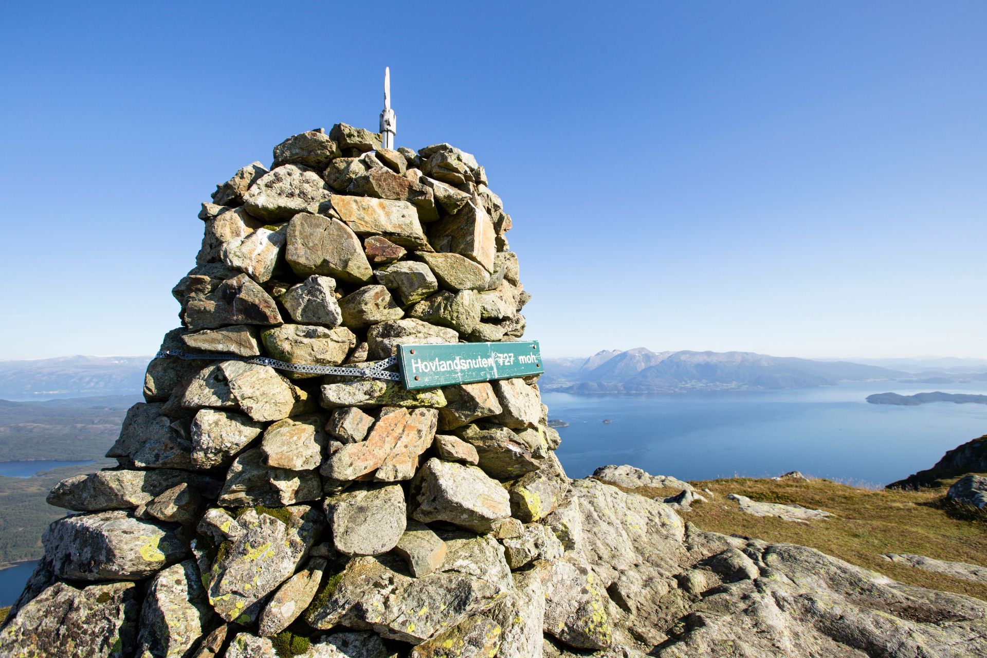
Hike to majestic Hovlandsnuten (727 m.)
If Tysnessåto (753 metres above sea level) is the king of Tysnesfjellet, then Hovlandsnuten is undoubtedly the queen. For many, the view from this peak is the most spectacular on Tysnes.
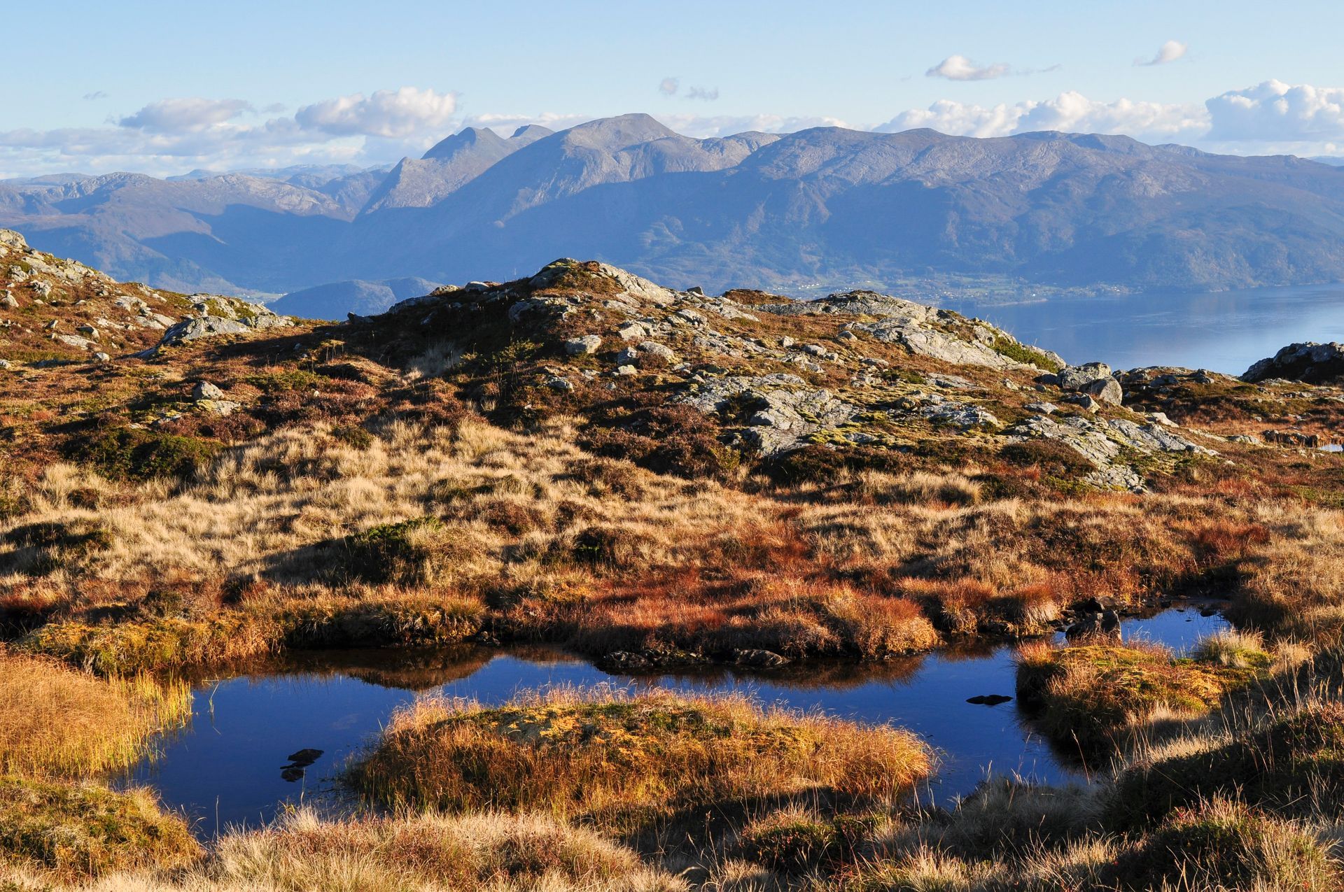
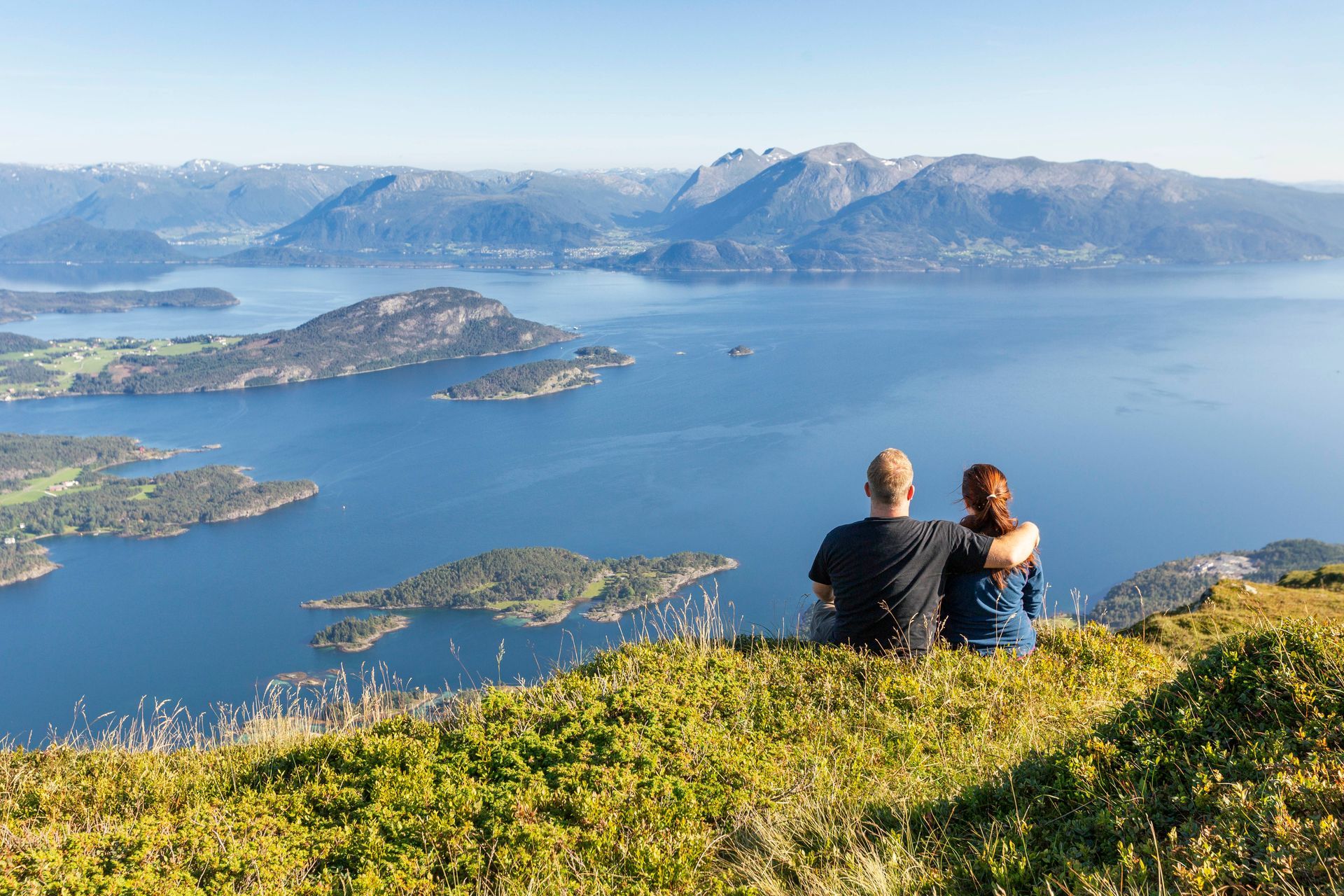
At this summit, you can almost sit with your legs dangling over the edge, looking down on the village below while admiring the dramatic mountains of Kvinnherad across the Onarheim Fjord. And if the fjord is mirror calm, chances are you'll be completely won over.
In this article, you'll find descriptions of two different routes to Hovlandsnuten: one from Skaret and one from Årbakka. If possible, it can be a great idea to hike up one way and return the other, provided you and your companions can leave a car at each starting point. The drive between the two trailheads takes just five minutes.
Skaret - Vasstøl - Hovlandsnuten
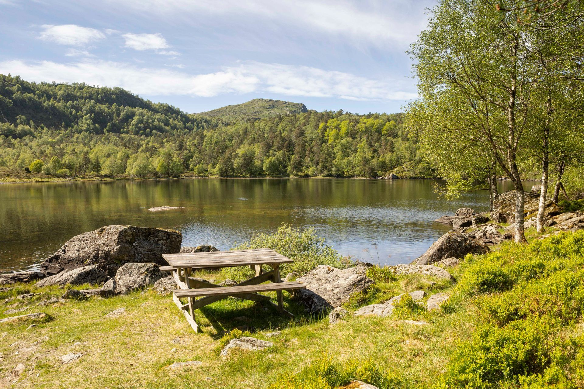
This popular trail passes one of the island’s most beautiful waterfalls and a picturesque lake.
Parking
There is ample parking along County Road 78 between Vevatne and Nymark/Hovland. On Google Maps, the location is marked as “Turparkering: Hovlandsnuten”. See the map
HERE.
Trail description
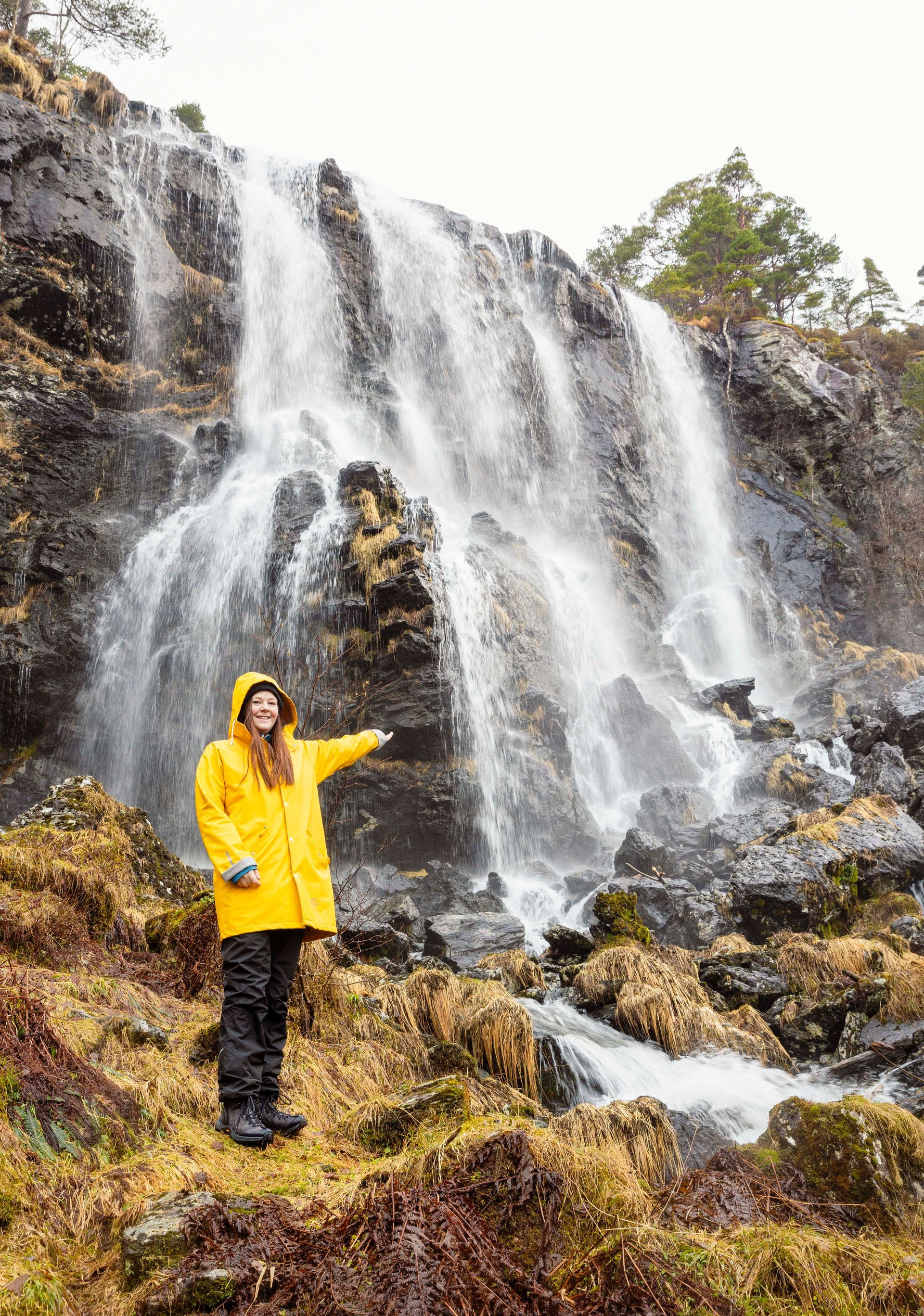
The first half hour of the hike follows a well-maintained forest road towards Vasstøl. After just a few minutes, you will see the beautiful Fossane waterfall on your right-hand side. The stream that feeds the waterfall will accompany you several times further up the trail, and you may even spot trout in its clear waters.
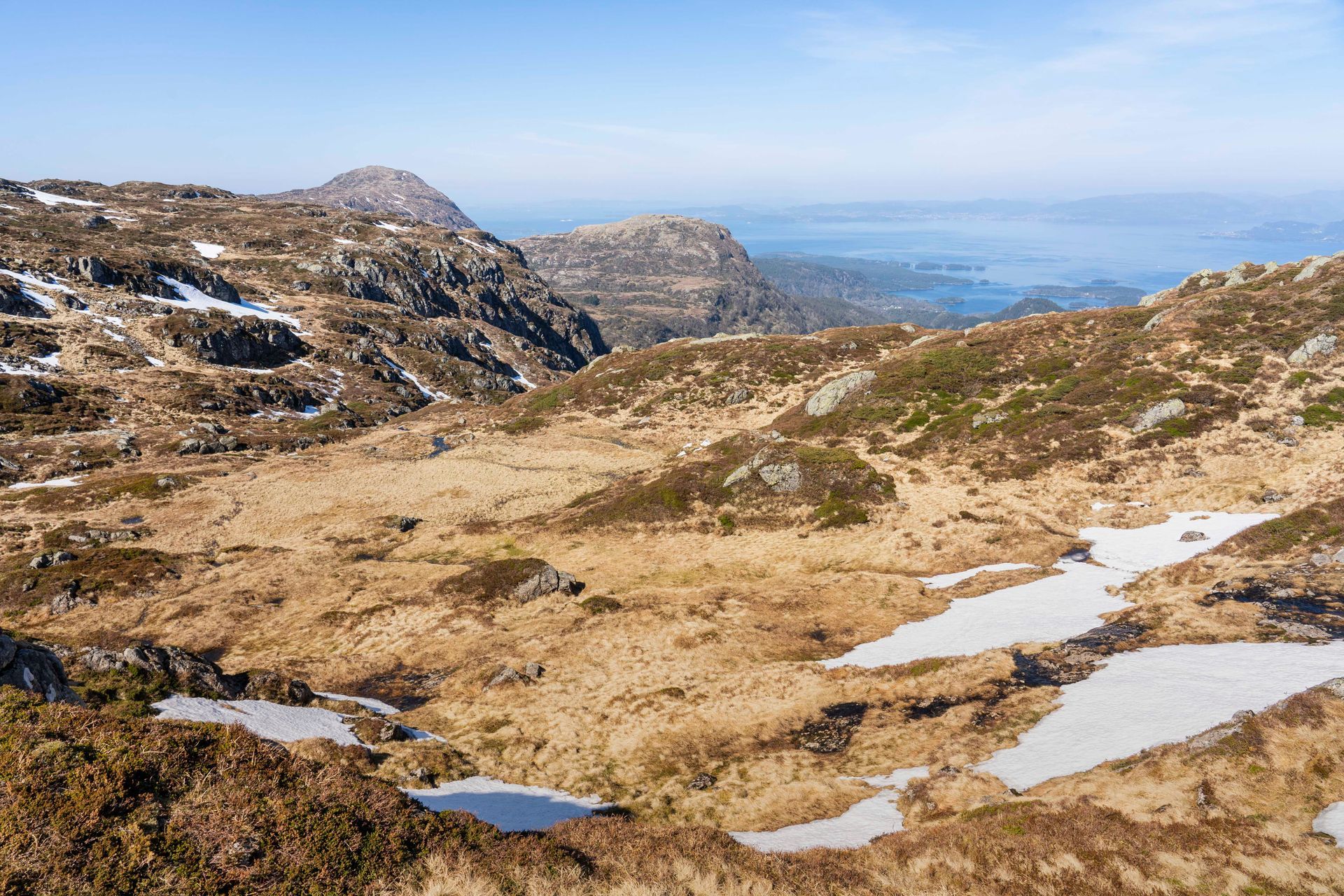
When you reach Vasstølstjødno, follow the trail to the left along the lake. On the far side (follow the signs), turn left again and begin the increasingly steep ascent through Sandlopeskaret. From Vasstøl to Hovlandsnuten, it is a 3-kilometre hike that takes around one hour, depending on your fitness level. The trail is at times steep and rocky, but it is well marked and easy to follow. Higher up, the landscape gradually changes to heather-covered terrain and low shrubbery.
Trail marking
There is an information board at the trailhead, and the route is well signposted and clearly marked.
Difficulty
Red. Demanding due to steep sections.
Elevation gain and distance
170-727 meters. Length about 4 km up.
Duration
1.5-2 hours from the parking lot to the top.
Be sure to bring something tasty to eat – you'll probably want to sit and enjoy the view for a while! 😊
Årbakka - Svinadalen - Hovlandsnuten
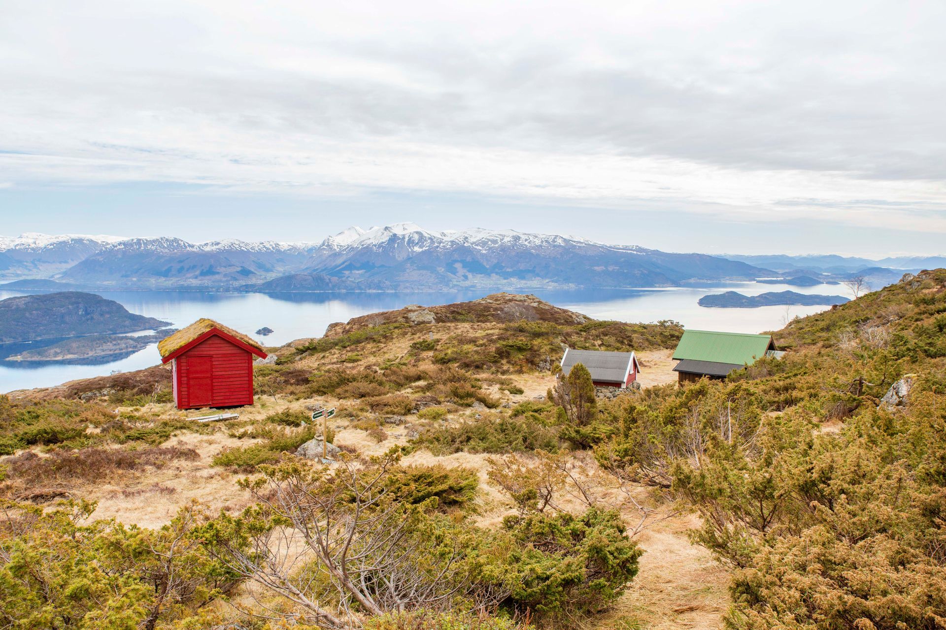
This hike starts down in the village and passes a charming mountain pasture with traditional cabins.
Parking
Park by the old yellow garage a few hundred metres south of the turn-off to Årbakka Handelsstad along County Road 78. See the map
HERE.
Trail description
From the parking area, walk approximately 500 metres north along the county road before turning left onto Liavegen. Follow the road all the way to the end, where you will find two old stone barns. Pass through the gate and follow the trail uphill.
The route then continues through a spruce forest on steep terrain. As you gain altitude, the landscape opens up, but this is definitely a hike that will put your fitness to the test. Beautiful Svinadalen (see photo below) lies along the route and offers a perfect place for a short break. Take a moment to enjoy the mountain cabins and the views before continuing your ascent towards Hovlandsnuten.
You can expect the hike to take around one hour to Svinadalen and a further 30 minutes from there to the summit.
Trail marking
The trail is signposted and T-marked.
Grading
Red. Demanding due to steep sections
Elevation gain
60-727 m
Duration
Approximately
1.5–2 hours from the parking area to the summit.
Enjoy your hike!